
Stormy weather is expected to threaten parts of the Interstate 95 corridor along the Eastern Seaboard on Saturday, according to FOX Weather.
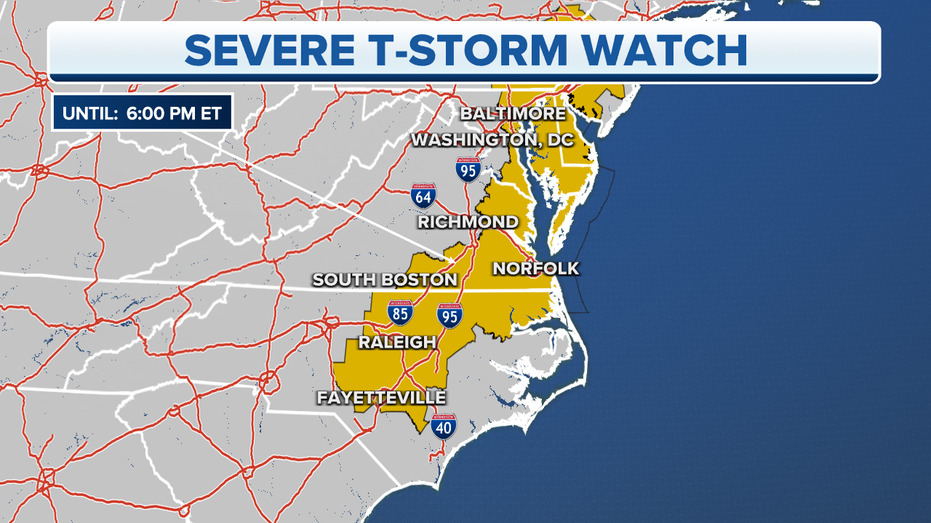
Portions of the Interstate 95 corridor between Baltimore and Raleigh, North Carolina are under a Severe Thunderstorm Watch. Affected states include southeastern Pennsylvania, Virginia and South Carolina.
The storms were caused by a cold front that crossed over the Great Plains on Tuesday. From there, storms developed and struck Oklahoma and Texas, with at least three people dying due to tornados in Cole, Oklahoma.
Oklahoma also experienced several tornados near its capital, Oklahoma City.
COLORADO MAN WHO SURVIVED AVALANCHE ‘DESPERATELY’ SEARCHING FOR PET DOG WHO WENT MISSING IN SLIDE
The cities and towns within the yellow watch box are expected to get hail up to 1″ in diameter. Wind gusts up to 70 miles per hour are also possible.
“This is going to mostly be for the afternoon into the evening hours. Large hail could be a threat and damaging winds will also be a possibility,” FOX Weather meteorologist Stephen Morgan explained. “So, let’s not be surprised if we do see some hail associated with this storm. And this does include the Outer Banks of North Carolina.”
‘DAMAGING’ TORNADOES SWEEP THROUGH OKLAHOMA, LEAVING AT LEAST 2 DEAD
While tornados are unlikely, they are still possible under a Severe Thunderstorm Watch.
The FOX Forecast Center is monitoring the region for severe hail and 60-plus-mph wind gusts.